Texas Medical Center / Inner Loop
Inner Loop business and interoffice runs
24/7 scheduling available, after-hours runs by advance booking
Dispatch: (281) 550-1212
Service Areas
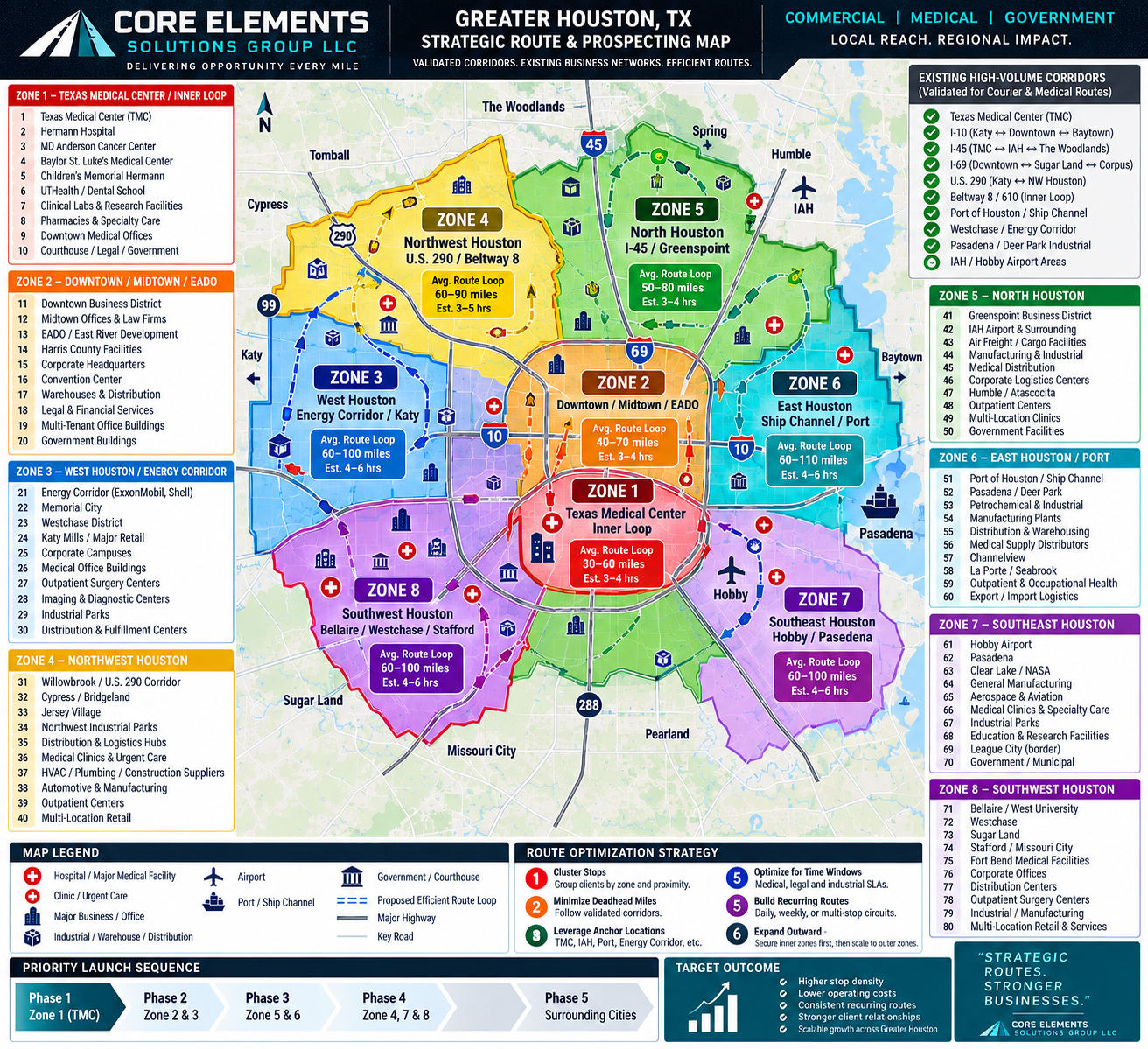
How We Plan
Every zone is planned around validated corridors and existing business networks — clustered stops, efficient loops, and a priority launch sequence that starts in the North, Northwest, East, and Southeast industrial corridors and expands outward.
Inner Loop business and interoffice runs
Legal, professional & interoffice runs
Corporate and industrial supply
Distribution and contractor supply
Airport-adjacent and freight support
Industrial and port-area logistics
Manufacturing and industrial corridors
Multi-location commercial routes
Coverage extends north and northeast of the metro area, including:
Outside these corridors? Longer-haul and dedicated runs are reviewed case by case based on mileage, timing, and available capacity.
Check my route